Why we measure this
By area, agriculture is the dominant form of land use in southern Saskatchewan. Agricultural lands – or lands used for the production of crops and livestock – occupy most of the province south of the commercial forest. They also encompass land not exclusively dedicated to production, including wetlands and woodlands.
Good agricultural land management not only keeps land healthy and productive, it contributes to biodiversity, soil conservation and habitat availability for wild species. While the main intent of farming is food and forage, land management impacts natural processes necessary to sustain adequate water supplies, a stable climate and other important benefits for people and the economy.
Saskatchewan will continue to monitor trends in agricultural land management to ensure we are keeping agricultural landscapes healthy and productive, and sustaining joint biodiversity benefits.
What is happening

For the information available, agricultural land use in Saskatchewan has remained relatively stable.

Note: Due to abnormally wet growing seasons in 2010 and 2011, land that couldn't be seeded because of excess moisture was reported to the Census of Agriculture as too wet to seed and is categorized in this figure as all other land.

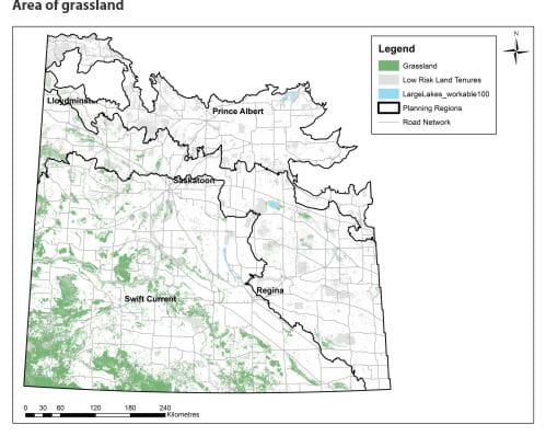
Temperate grasslands are one of the most endangered ecosystems in the world. Most estimates suggest somewhere between 19 and 24 per cent of grassland cover remains in Saskatchewan. Many grassland wildlife species are experiencing population declines and many federally listed species at risk in the province rely on remaining patches of managed grassland. Grasslands also support Saskatchewan's beef industry. As such, it is important to conserve remaining grassland habitat for wildlife and people alike. Increasing the area of permanent cover, including grasslands, is a component of the Government of Saskatchewan's Prairie Resilience framework. This measure will increase resilience and help mitigate climate change.
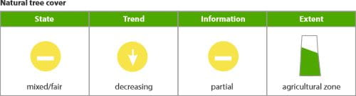
Conservation of tree cover provides important habitat for forest-associated wildlife species, including economically important species such as white-tailed deer. Like other natural land covers, trees in agricultural landscapes retain stored carbon and improve resilience to climate change.
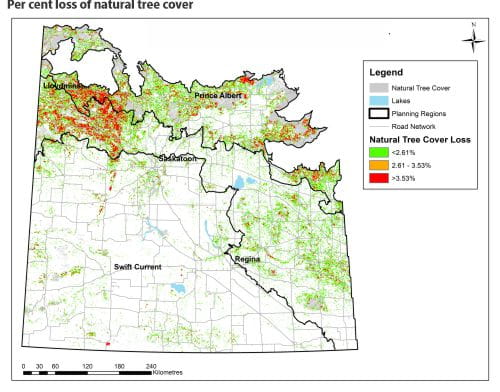
Natural tree cover is the percent loss of natural tree cover per quarter section between 2012 and 2017.
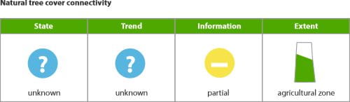
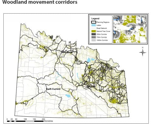
Fragmentation of movement corridors for wildlife can occur when woodland patches are removed. The closer neighbouring patches are together, the more readily wildlife species can travel to find food, mates and living space. Conserving movement corridors helps facilitate dispersal and maintain resilience among populations of wide-ranging species.
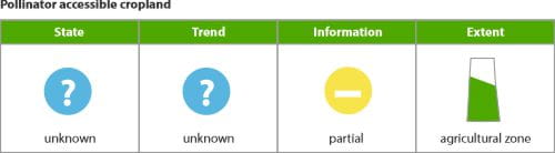
Pollinator-accessible cropland is the proportion of cropland within 200 metres of natural land covers in landscape areas dominated by agriculture.
Flying insects such as bees and flies are responsible for pollinating several crop species popular in Saskatchewan, including canola, flax, mustard, buckwheat and coriander. Cross-pollination by insects can increase crop yields by up to 30 per cent. Natural land cover patches adjacent to cropland facilitate cross-pollination by providing nesting and foraging sites for insect pollinators. This is especially important in agriculture-dominated landscapes where the maximum benefit of cross-pollination is jeopardized by increasing isolation from natural patches where insect pollinators reside. Maintaining natural patches dispersed across agriculture-dominated landscapes will continue to facilitate cross- pollination by insects.

What we are doing
Land management remains a priority for Saskatchewan.
Government is continuing to support programs and services such as the Fish and Wildlife Development Fund, the Environmental Sustainability and Climate Change component of the Federal-Provincial Canadian Agricultural Partnership, the Agricultural Water Management Strategy and lease arrangements with private Agricultural Crown Land lessees and pasture patrons. This also includes collaborating with agricultural producers to achieve targets identified in the Prairie Resilience climate change strategy and Climate Resilience Measurement Framework.